
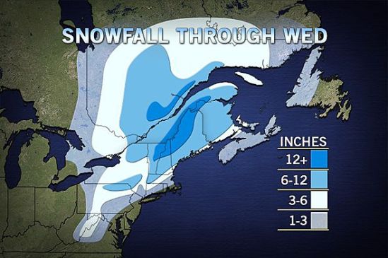
Well here comes another big complex storm into the area for Monday night into Tuesday. Inland portions of the northeast could see well over a foot from this storm!! Closer to the coast of Connecticut, we should only see a slushy inch or two before it mixes and changes to rain on Tuesday morning. This is going to have to be watched closely as some spots might hang close to the freezing mark early Tuesday, and there could be a prolonged period of freezing rain.
This will heavily impact travel for the Tuesday morning commute! Take the necessary precautions and take it slow out there! Any spots that get a substantial amount of this heavy wet snow, need to be prepared for the chance of power outages. The wet snow will cling to the tree limbs and power lines, and the strong winds will combine to bring many of these limbs and power lines down! Stay tuned for the latest! -SS
