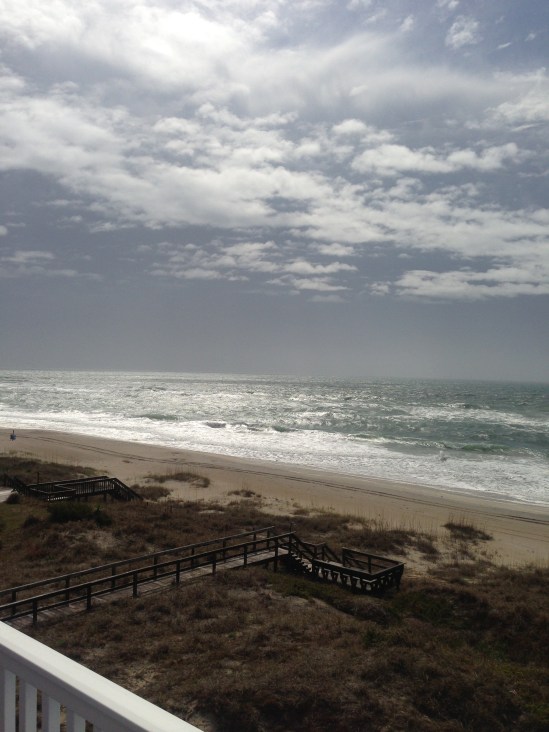
Sorry everybody I took the weekend off to celebrate my engagement! This here is my view for the week while I am in Emerald Isle, NC in the outer banks! Ill get back to weather soon! -SS

Sorry everybody I took the weekend off to celebrate my engagement! This here is my view for the week while I am in Emerald Isle, NC in the outer banks! Ill get back to weather soon! -SS
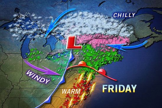
A mix of rain, ice, and snow will make its way through the region on Friday. Luckily for us in CT, it will all be in the liquid form. We will still have very strong winds, and minor coastal flooding. Stay dry! -SS

That huge system will finally make its way out of the plains and into the northeast. It has dropped over 2 feet of snow in some parts of the west, and tornadoes in the Deep South! It won’t be quite as bad for us up here in the northeast. In Connecticut we can expect a good soaking rain during the daytime tomorrow. It should be done by the nighttime, and we can again expect a period of cool but dry and pleasant weather to take over. Take caution anybody going north tonight as there will actually be a widespread area of snow and ice shaping up in northern New England. Take it slow out there! -SS
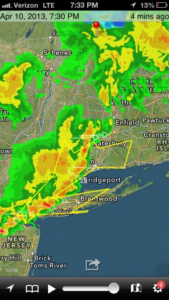
This is the current radar.. Heavy showers with embedded thunderstorms making there way into the area! Take cover! -SS
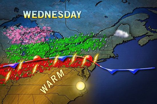
Showers and thundershowers will move into the area this evening. This front that i have been talking about for a week will drop south through the area today and bring with it the monster storm out of the plains, This is a beast of a storm as it has dropped over 2 feet of snow in some parts, and also tornadoes and severe storms. We have the chance for storms in the forecast, but nothing severe should make it up this way. The showers will continue all the way into Friday, and the entire area can expect 1-2 inches of rain over the next couple days.
The weather looks to again be cooler when the storm passes, and into next week. For everybody that loved the summer warm-up the last couple days, don’t get used to it as we shouldn’t even hit 60 degrees until midweek next week. Stay dry! -SS
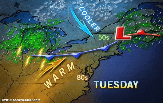
As the cold front is still north of us, the warm air will push further north today. It will give us our warmest temps so far this year. Some record highs have already been recorded in parts of NY state. Do what you gotta do, take off work, call out, just get outside and get some sun. This warm weather will only last into tomorrow as the front drops down to the south of us and brings showers and cooler weather with it. Get outside! -SS
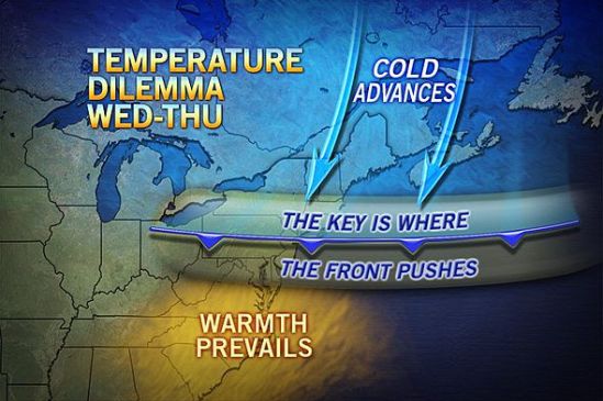
What a stellar day today! Nicest day of the year so far! Enjoy it now, because it is not going to last. Remember last week I posted about that stationary front for this week? Well today we are on the warm side, but after tomorrow or even Wednesday, the front will drop back down to the south of us, dropping us back into the 40s and 50s with some showers around for the rest of the week.There is still a chance it stops just north of us, and we could even be approaching the 70s tomorrow and Wednesday. It’s tough to say right now where it will set up. Stay tuned and get outside and enjoy today! -SS

I just thought I’d post this satellite picture because its pretty cool how well it shows the snow cover still on the ground. All the white over land is snow still on the ground, and the white over the water is clouds. You can see a lot of Vermont and upstate New York still very snow covered, and the bright white just east of Lake Superior. That’s fresh lake effect snow from this past week, when they got feet of snow! All of southern New England is now snow free and ready for warm weather! -SS

Beautiful Saturday on tap. As we head into the weekend, it looks like Spring is finally starting to take over. It will be sunny today, but just a little chilly. It should only be about 50 degrees for a high temp. The next couple days it should get into the 60s! So get excited for that! its been a long time coming. -SS
The big coastal storm that we were watching today, will just miss us. As you can see we are right on the very edge of this storm. Throughout the day it will move farther away an in turn we will get sunnier and warmer. Unfortunately right on the heels of this storm is a cold front that will move through tonight. It doesn’t have much precipitation with it, but it will cool it down somewhat. Tomorrow looks to be beautiful and sunny but chillier again. As highs will struggle to reach 50 degrees. Into next week we will be dealing with that stalled out stationary with associated Showers and cooler temps for most of the week. -SS
