
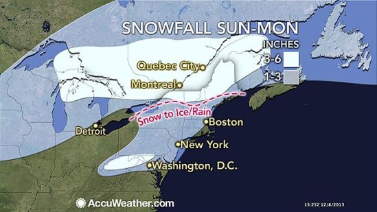
A potent winter storm will continue to spread an icy mix from the Ohio Valley to the mid-Atlantic and Northeast through the remainder of the weekend. The icy mix and freezing drizzle are making travel treacherous. Enough freezing rain threatens to coat parts of the Ohio Valley, mid-Atlantic and Northeast for some power outages and tree damage.
Here in southern CT, we can expect some light snow to begin by sunset tonight. That snow will slowly transition to a wintry mix into the overnight. By daybreak, coastal communities will go to just plain rain, while inland areas may stay as some wintry mix or even freezing rain and icing conditions. There will a general slushy snow and ice accumulation of 1-3 inches throughout the area.
Everybody should expect a very sloppy morning commute, with school delays and even closings possible. Take it slow and don’t drive if you don’t have to! It will be treacherous through the overnight! -SS
