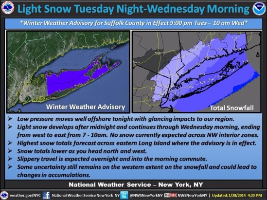
I started watching this storm about a week ago, when It looked like it had the potential to be an all out blizzard for us here in the northeast. As it got closer though, computer models started to come into agreement that it would in fact not crush the northeast. It started to look like it would just roll off the southeast coast and straight out to sea, and not barrel up the coast and turn into a monster nor’easter. As the storm is now formed, and is currently dropping unprecedented heavy snow and ice on the Deep South all the way to the gulf coast! It now looks like it will in fact give us a glancing blow and drop a quick couple inches across the state tonight. Careful in the morning as roads will be treacherous. There should be some delays out there for all you teachers! Happy Tuesday! -SS

