
Sorry I have been quiet all but I am in Vermont preparing to shred this beast! Winter is finally rearing her beautiful face and she is ready to rip. Right on the heels of the early week storm, comes another behemoth. We also have a potentially bigger storm for the end of the weekend!
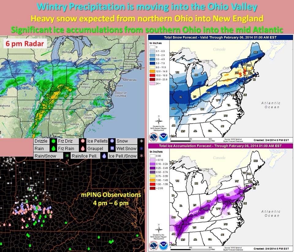
Dealing with this current monster is fun, because this looks like a real good chance for widespread 1ft + snowfall for most of the northeast. Not so much in CT, but still a significant storm none the less. Parts of CT should see a foot or more, but that will be confined to the northern half of the state. Especially in the northwest hills where there could be over a foot! Along the coast there should be 3-6 inches of snow with a nice sleet layer and then up to a quarter inch of freezing rain on top.
All precip should start pre-dawn and should be very heavy through the morning hours. With Snowfall rates of an inch an hour or more in some places! The snow will stay falling heavy at times in the inland, but along the coast it will mix with and change to freezing rain and sleet. In some warmer spots right on the coast, it will be just warm enough for it to go to all rain. All precip should be done by the evening hours from west to east.
This is not going to be a very long duration event, but the precip will be very heavy much of the time. Exercise extreme caution if you have to be out tomorrow. Take it slow on the roads.
More to come on this weekend storm and don’t look now but there is even a valentines day storm in the works! More to come! -SS

P.S. The big winner should be the berkshires in western mass and green mountains in southern VT where upwards of 20 inches is possible!!