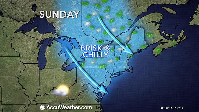
As the temps start to drop, it is time for Stevie Storms to make his comeback! The temps will be dropping sharply overnight tonight into Sunday. Many locations across the Northeast will feel like mid-November as the weekend progresses with the arrival of colder air and gusty winds. After a warm and rainy week, a blast of chilly air from Canada will arrive in the Northeast for the weekend. Many locations experienced temperatures between 15 and 20 F above average for this time of year this past week. However, by Sunday many locations will run 5 to 10 degrees below average. The 20- to 30-degree change will be quite noticeable for many people. A cold front will breeze through the area this weekend with spotty showers. Temperatures might even be low enough to see the first snowflakes of the year in some areas of northern New England into Sunday morning. The chilly air will settle in on Sunday on gusty northwest winds across the entire Northeast. The November-like conditions will persist over the Northeast into the beginning of next week. A storm system off the mid-Atlantic coast during the middle of next week could bring periods of heavy rain and gusty winds to the entire region. Expect another post to follow on the potential for a midweek Nor’easter coming up this week! -SS