
 .
.
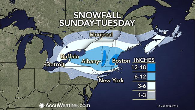
As the last storm in this series of storms heads in, It will be the strongest of the bunch. This storm will feature a wide range of snow and ice totals. With the heaviest falling from northern CT on northward. There will be a swath near Boston and southern Vt that could see up to 2 feet! There will be a general 8-12 for most of the northeast, with the exception of southern coastal CT that gets only 3-6 because of some mixing and changing to sleet and freezing rain on Sunday night, before changing to all snow on Monday morning. The bulk of the snow should be gone by Monday night, but some lingering snow showers should stick around until Tuesday for the mountains of northern New England. There is another chance for some snow on Thursday, and that storm will be followed by the coldest air of the season. Stay tuned! -SS
