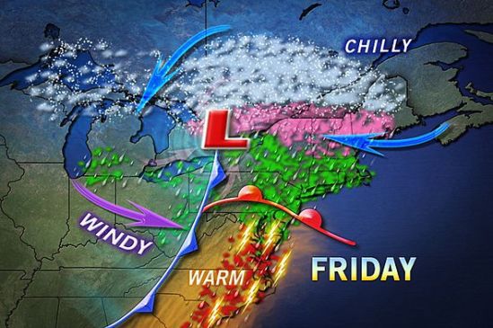
A mix of rain, ice, and snow will make its way through the region on Friday. Luckily for us in CT, it will all be in the liquid form. We will still have very strong winds, and minor coastal flooding. Stay dry! -SS

A mix of rain, ice, and snow will make its way through the region on Friday. Luckily for us in CT, it will all be in the liquid form. We will still have very strong winds, and minor coastal flooding. Stay dry! -SS
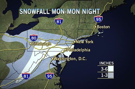
The storm as it looks now, has taken more of a right turn, and will go out to sea. This map still has 1-3 inches for the very immediate coast of Connecticut, but i doubt anyone sees even one inch of snow. This storm will bring nothing more than some mixed rain and snow showers this evening, mainly on the coast. With such a large storm nearby, it will be a little breezy today, and there is a chance for some minor coastal flooding.
On the bright side, the extended forecast is showing no snow at this time, and even a slight warming trend! Stay tuned for spring! -SS
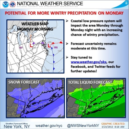
This map puts southern CT with about 2 inches of wet snow for Monday! With a big unpredictable coastal storm, there is a still a lot of uncertainty with the forecast. The exact track is hard to nail down, and just a little jog in the track can greatly Increase and decrease the snowfall totals. As it gets closer we will have a better idea what’s coming! Stay tuned! -SS
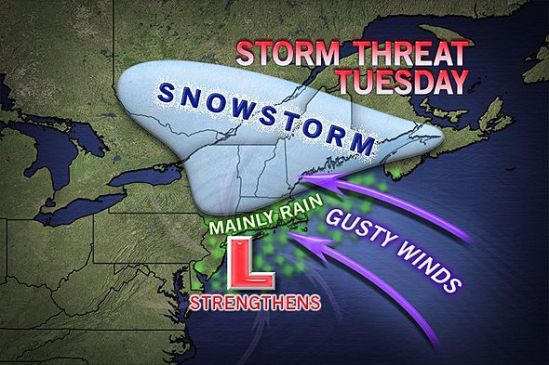
As it looks right now, northern New England looks to be in the bulls eye for heavy snow on this one. This storm will move in later in the day on Monday. It could start as some snow or mixed precipitation for everybody all the way to the coast. The storm will strengthen off the coast and wrap in lots of moisture and warmer air which will change any mix or snow to all rain for Connecticut. There are still some uncertainties with the exact track, and a little deviation could mean more snow for parts of Connecticut. As it gets closer, we will have a better idea of how much snow! I will keep you posted! -SS
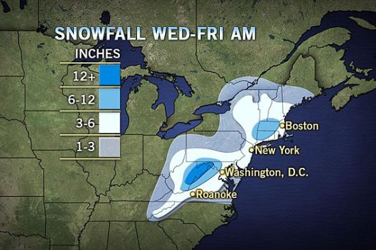
As of today, It looks like most of Connecticut should see over 6 inches of snow!!!! This is a big change from over the last couple days! Precipitation should start tommorrow afternoon and last all the way until Friday for eastern sections.
This is a very complex and potent storm that needs to be taken very seriously! it will not take much of a shift in storm track to double these current projections of snowfall! Stay tuned! lots to come- SS
