Big coastal storm for Tuesday

Big coastal storm for Tuesday

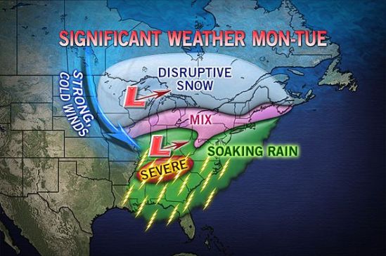
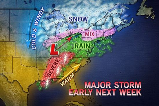
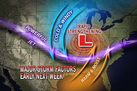
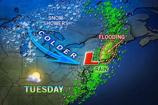
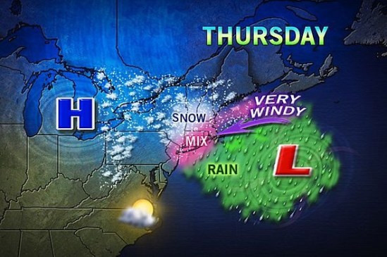
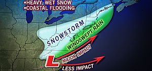
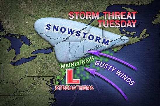
As it looks right now, northern New England looks to be in the bulls eye for heavy snow on this one. This storm will move in later in the day on Monday. It could start as some snow or mixed precipitation for everybody all the way to the coast. The storm will strengthen off the coast and wrap in lots of moisture and warmer air which will change any mix or snow to all rain for Connecticut. There are still some uncertainties with the exact track, and a little deviation could mean more snow for parts of Connecticut. As it gets closer, we will have a better idea of how much snow! I will keep you posted! -SS

Still watching early week storm

Still watching early week storm

This storm is still something to watch. It looks like a big mess of precipitation coming into the area sometime Monday afternoon or evening. It will drop some heavy snow inland and a mix of precip for the coast. There is going to be more coastal flooding and also wind gusts of 50-60 mph. As it gets closer we”ll have a better idea of what kind and how much precip will fall. I’ll keep you posted! -SS

Potent storm potential next week

Potent storm potential next week

We are also watching the chance of a potent storm coming together somewhere in the time frame of Monday-Wednesday for the northeast. While it looks to be a mainly rain event here in Connecticut, inland portions need to watch this very closely. It could drop a good deal of heavy wet snow and rain on already very saturated soil from this weeks rain and melting snow. This will pose a flooding risk for lots of people in its path. This is something to watch, and I will keep you posted! -SS

Potential major storm next week

Potential major storm next week

This storm is currently over the northern Pacific, and it’s looking to cause cross-country trouble next week, from the northern Rockies to the Midwest and eventually to us in the Northeast.

Early indications are that the storm will grow large and strong after negotiating the Rockies this weekend. It will have an opportunity to tap into Gulf of Mexico and Atlantic moisture as it progresses eastward during the first part of next week.
A storm of this nature has the potential to bring strong wind as well as areas of heavy snow on its northern flank, strong thunderstorms on its southern flank and drenching rain in the middle.
Like many storms a week or so away, the track is key to determining where the boundary of rain and snow will set up. We will have to wait and see how much warm air gets pulled into this storm as it makes it’s way east. Ill keep you posted on this evolving storm. -SS

Flooding rains today

Flooding rains today

There will be a widespread swath of 1-2 inches of rain today. This combined with lots of melting snow pack will make the conditions favorable for minor to moderate flooding. In the urban areas, there are still covered and blocked storm drains which are causing some ponding of roads. In outlying areas, small streams and rivers are being filled up by the rain and melting snow. Take it slow out there, and remember not to drive through any water covered roadway. You don’t know how deep the water could be! Stay dry! -SS

Snow’s a coming

Snow's a coming

Well the advisories are posted, and this beast of a storm is knocking on our doorstep. It’s looking like It should start up this afternoon as just some rain showers here in southern CT. As the day goes on, and the precipitation increases, it will mix with and change to snow. It should snow most of the night, dropping about 3-6 inches into tomorrow. Tomorrow it should go to just a light mix of rain and snow showers, but as the storm pulls away and interacts with an upper level low it should bring some heavier bands across the area again tomorrow night. That should drop an additional 1-3 inches.

I am on my way to NYC to catch a flight to Denver, CO. I will be skiing Vail for the weekend and will miss this storm. Hopefully my flight is good for a 5pm departure. We’ll see how windy it is down that way. I will not be able to post much, but i will do my best. Enjoy the storm and watch for very strong winds and coastal flooding tonight. -SS

***Tracking new storm***

***Tracking new storm***

Potential Monster storm for the middle of next week. It will probably be March 6-7. This storm is showing early signs of being a monster! We could be talking about major coastal flooding and the potential for power outages with the high winds. It’s too early to say whether or not we will see snow or rain in southern New England, but needless to say something is coming.

This could be a big time March storm like we’ve seen so many times over the years. Its not going to take a big change in this storm to bring feet of snow instead of inches of rain. I will keep updating this as we get closer. I love how mother nature knows i am supposed to fly out to denver on Wednesday. Something to watch -SS