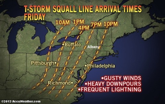
Watching the cold front with associated squall line of storms for Friday night! This visual should give you a good idea on arrival times. Stay safe! -SS

Watching the cold front with associated squall line of storms for Friday night! This visual should give you a good idea on arrival times. Stay safe! -SS

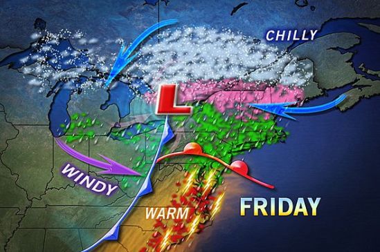
A cold front bringing severe weather to the Midwest and the Mississippi Valley Thursday will reach the East on Friday producing rain, and locally gusty thunderstorms.
While the intensity of the thunderstorms will depend to some extent on the timing, and on how warm locations become during the day. Most locations from Florida to Maine will get a period of drenching rain. Areas most likely to experience localized strong to severe thunderstorms will be generally near and south of the Mason-Dixon line.
Some locations can be hit by more than just a downpour and some lightning and thunder. A few places can have a severe thunderstorm that brings strong winds, torrential downpours and hail. As a result, there is the potential for downed trees, power outages and flash flooding in the vicinity of the storms.
The storms will be the remnants of a squall line affecting the Central states today into tonight. It will not be until the overnight and early Saturday morning hours before they reach the east coast of New England.
There is the potential for 1-2 inches of rain along a large part of the Atlantic Seaboard. Much cooler and drier air will sweep in over much of the Eastern states this weekend. Wet snowflakes could even mix in over the highest elevations of northern Pennsylvania and upstate New York Saturday. -SS
A mix of rain, ice, and snow will make its way through the region on Friday. Luckily for us in CT, it will all be in the liquid form. We will still have very strong winds, and minor coastal flooding. Stay dry! -SS
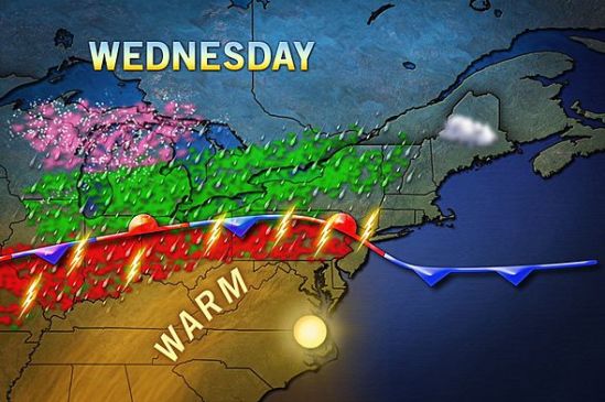
Showers and thundershowers will move into the area this evening. This front that i have been talking about for a week will drop south through the area today and bring with it the monster storm out of the plains, This is a beast of a storm as it has dropped over 2 feet of snow in some parts, and also tornadoes and severe storms. We have the chance for storms in the forecast, but nothing severe should make it up this way. The showers will continue all the way into Friday, and the entire area can expect 1-2 inches of rain over the next couple days.
The weather looks to again be cooler when the storm passes, and into next week. For everybody that loved the summer warm-up the last couple days, don’t get used to it as we shouldn’t even hit 60 degrees until midweek next week. Stay dry! -SS
The big coastal storm that we were watching today, will just miss us. As you can see we are right on the very edge of this storm. Throughout the day it will move farther away an in turn we will get sunnier and warmer. Unfortunately right on the heels of this storm is a cold front that will move through tonight. It doesn’t have much precipitation with it, but it will cool it down somewhat. Tomorrow looks to be beautiful and sunny but chillier again. As highs will struggle to reach 50 degrees. Into next week we will be dealing with that stalled out stationary with associated Showers and cooler temps for most of the week. -SS
The storm as it looks now, has taken more of a right turn, and will go out to sea. This map still has 1-3 inches for the very immediate coast of Connecticut, but i doubt anyone sees even one inch of snow. This storm will bring nothing more than some mixed rain and snow showers this evening, mainly on the coast. With such a large storm nearby, it will be a little breezy today, and there is a chance for some minor coastal flooding.
On the bright side, the extended forecast is showing no snow at this time, and even a slight warming trend! Stay tuned for spring! -SS
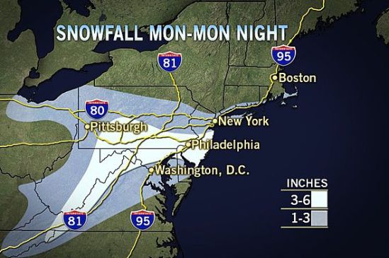
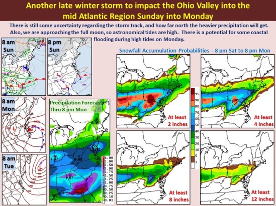
Southern Connecticut will be on the northern most edge of this next large winter storm. The track is still not set in stone, and just a little change in track will greatly increase or decrease snowfall! As it looks now, we should only see a slushy inch or two. Snow will start Monday morning and continue through the day. It will mix with rain at times in the afternoon, but into the evening it will change back to all snow. This does not look like a major storm (for us) as it is right now, but it will need to be watched as it could still drop a sneak attack several inches in some places! Keep you posted! -SS
This map puts southern CT with about 2 inches of wet snow for Monday! With a big unpredictable coastal storm, there is a still a lot of uncertainty with the forecast. The exact track is hard to nail down, and just a little jog in the track can greatly Increase and decrease the snowfall totals. As it gets closer we will have a better idea what’s coming! Stay tuned! -SS
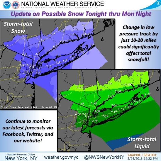
This photo shows our chances of accumulating snow for Sunday night into Monday. At this point, it doesn’t look like a big deal for New Haven… We could still see 1-3 inches of snow Sunday night into Monday morning before it mixes with and changes to rain. More to come! -SS

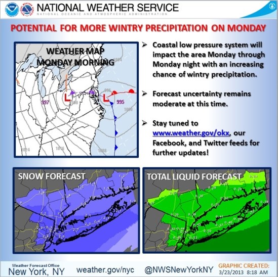
Just throwing it out there… We are watching the potential for another winter storm for early next week. This is the winter that just won’t quit! The storm should get here for Monday with another mixed bag of precipitation! Ill keep you posted! -SS
