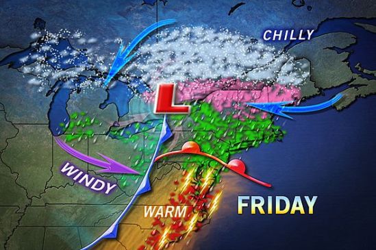
A mix of rain, ice, and snow will make its way through the region on Friday. Luckily for us in CT, it will all be in the liquid form. We will still have very strong winds, and minor coastal flooding. Stay dry! -SS

A mix of rain, ice, and snow will make its way through the region on Friday. Luckily for us in CT, it will all be in the liquid form. We will still have very strong winds, and minor coastal flooding. Stay dry! -SS
The storm as it looks now, has taken more of a right turn, and will go out to sea. This map still has 1-3 inches for the very immediate coast of Connecticut, but i doubt anyone sees even one inch of snow. This storm will bring nothing more than some mixed rain and snow showers this evening, mainly on the coast. With such a large storm nearby, it will be a little breezy today, and there is a chance for some minor coastal flooding.
On the bright side, the extended forecast is showing no snow at this time, and even a slight warming trend! Stay tuned for spring! -SS
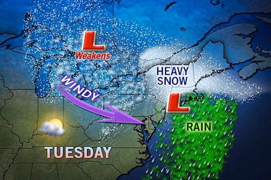
Southern Connecticut will be on the northern most edge of this next large winter storm. The track is still not set in stone, and just a little change in track will greatly increase or decrease snowfall! As it looks now, we should only see a slushy inch or two. Snow will start Monday morning and continue through the day. It will mix with rain at times in the afternoon, but into the evening it will change back to all snow. This does not look like a major storm (for us) as it is right now, but it will need to be watched as it could still drop a sneak attack several inches in some places! Keep you posted! -SS
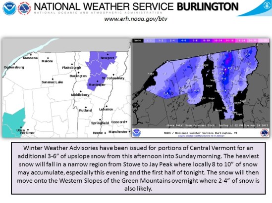
Additional snow for the north country this weekend! This seems to be the ski season that just won’t quit!! They’re calling for 6-10 inches in the normal snow Zone from Stowe, VT to Jay peak!! 3-6 elsewhere! At this rate, spring skiing will be epic this year! Let it snow! -SS
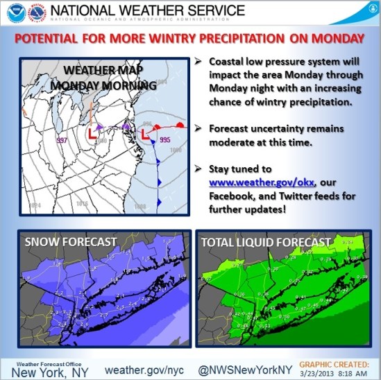
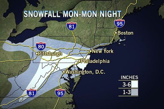
This map puts southern CT with about 2 inches of wet snow for Monday! With a big unpredictable coastal storm, there is a still a lot of uncertainty with the forecast. The exact track is hard to nail down, and just a little jog in the track can greatly Increase and decrease the snowfall totals. As it gets closer we will have a better idea what’s coming! Stay tuned! -SS
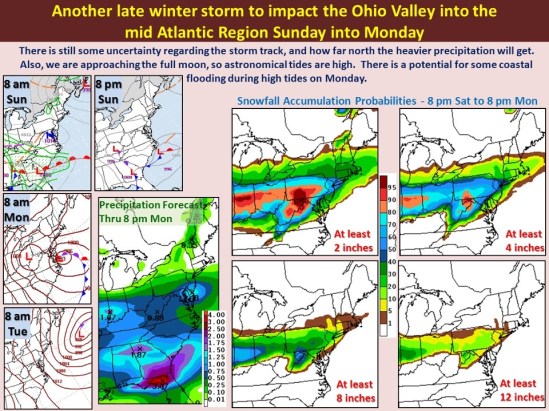
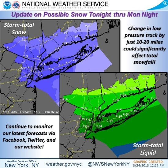
This photo shows our chances of accumulating snow for Sunday night into Monday. At this point, it doesn’t look like a big deal for New Haven… We could still see 1-3 inches of snow Sunday night into Monday morning before it mixes with and changes to rain. More to come! -SS

This post shows just how much more snow has fallen and stuck around compared to last year! This time last year we were already enjoying temperatures of 70 and almost 80 degrees! This is not the case this year, as we are stuck in a very chilly and stormy pattern!
If you look at this map, you can see that the only snow on the ground anywhere last year was just in the higher elevations of northern New York State! Compared to this year where there is a widespread area of at least 2 feet over upstate New York and Vermont! What a difference a year makes! Who needs global warming!?!?
The weather in the last week has dropped over 2 feet of fresh snow over most of Vermont, and this will help to continue a pretty good ski season well into springtime! Enjoy the great early spring conditions, and see you on the hill!
More to come on Mondays impending storm! -SS

Just throwing it out there… We are watching the potential for another winter storm for early next week. This is the winter that just won’t quit! The storm should get here for Monday with another mixed bag of precipitation! Ill keep you posted! -SS

Just a little quick hitting storm tonight into tomorrow morning with scattered wet snow showers and flurries. Shouldn’t be a whole lot. Just might make for some slick conditions in spots. -SS
As predicted, we got a few inches of snow last night. Overnight as warmer air moved in and temperatures rose above freezing, the snow transitioned to freezing rain, sleet, and finally rain. The rain will taper off to showers later on this evening. Be careful when venturing out as there might still be some slick spots on untreated side roads and sidewalks. Temperatures in a few inland spots are still below freezing, and icing conditions can still exist. Take it slow out there! Off to VT for me to enjoy this fresh powder on the slopes! -SS
