One scenario for next week

One scenario for next week

This is one of 2 scenarios that could play out around midweek next week. Now this is not set in stone by any means, but it is a possibility. If this were to play out this would be a full fledged blizzard with potentially hurricane force winds, coastal flooding, and feet of snow. The other scenario sends the huge storm out to sea with virtually no ill effects from it whatsoever! I will keep monitoring this situation and keep everyone posted! -SS

***Tracking new storm***

***Tracking new storm***

Potential Monster storm for the middle of next week. It will probably be March 6-7. This storm is showing early signs of being a monster! We could be talking about major coastal flooding and the potential for power outages with the high winds. It’s too early to say whether or not we will see snow or rain in southern New England, but needless to say something is coming.

This could be a big time March storm like we’ve seen so many times over the years. Its not going to take a big change in this storm to bring feet of snow instead of inches of rain. I will keep updating this as we get closer. I love how mother nature knows i am supposed to fly out to denver on Wednesday. Something to watch -SS

Snow stache!!

Somebody call Mother Nature a doctor cause she is getting sick! Just got done with an epic day skiing at Killington! 8-9 fresh inches on the ground and still dumping!

Best skiing of the year for me as of yet! That all might change next week when I make my first venture to Vail, CO.

I feel bad for all you flat landers stuck with all of those old dirty piles of snow! Make your way up to VT and rejoice in the powder! Heres to knee high powder stashes!! -SS

Here comes winter storm Rocky

Here comes winter storm Rocky

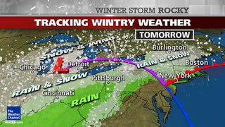
On Tuesday night, we welcome another storm into the northeast United States. No need to worry here in southern CT as it looks to be an all rain event. Depending on where you are you could see some snow or sleet mixing in tonight, but mainly just rain. This means Connecticut is in for 1-1.5 inches of rain between tonight all the way into Thursday.

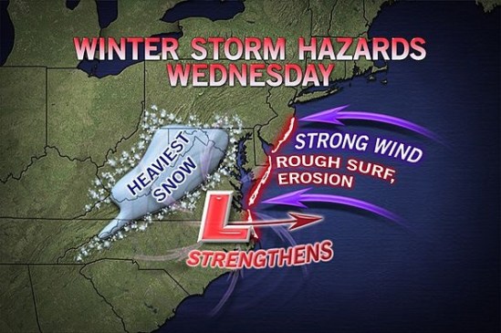
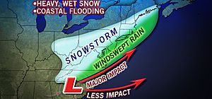
Up north it looks to be a different story. Into Massachusetts there should be a general sloppy 1-3 inches, with higher amounts in the higher elevations. Speaking of higher elevations, the mountains of Vermont and New Hampshire, and into Maine will see a large area of 6-12 inches. The higher elevations and usual snow belts could easily see 10-14 inches!!

There will also be a lot of wind associated with this storm. Therefore, wind advisories are posted for a lot of northern locations, and also a coastal flood advisory for the coast of Connecticut.

I am currently packing my bags and heading up into the great white north to partake in this fresh powder on the slopes of Killington! I Cant wait to escape the brown dirty piles of old snow everywhere and exchange them for endless fresh pillows of pow!

Enjoy the storm and stay dry! See you on the hill! -SS