Enjoy Today!

Enjoy Today!

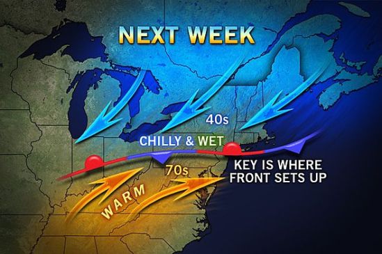
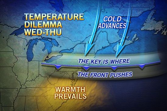
What a stellar day today! Nicest day of the year so far! Enjoy it now, because it is not going to last. Remember last week I posted about that stationary front for this week? Well today we are on the warm side, but after tomorrow or even Wednesday, the front will drop back down to the south of us, dropping us back into the 40s and 50s with some showers around for the rest of the week.There is still a chance it stops just north of us, and we could even be approaching the 70s tomorrow and Wednesday. It’s tough to say right now where it will set up. Stay tuned and get outside and enjoy today! -SS

Back and forth temps next week

Back and forth temps next week

A cold versus warm air battle zone is likely to set up this weekend into next week stretching from the Great Lakes to the Northeast.

Warmth will build over much of the Eastern states in the wake of the coastal storm for the end of this week. However, there will be some resisting cold air.

A frontal zone is likely to wobble from north to south and back multiple times across the northeastern part of the nation this weekend through next week. Areas south of the front will surge into the 70s during multiple days with sunshine. However, areas north of the front will stay around the 30s and 40s. In some cases, the stubborn chilly air will be accompanied by clouds, rain, fog and drizzle.

The frontal zone could set up near the U.S./Canada border or could set up near the Mason-Dixon line or possibly even farther south. Depending on where it does set up, it could move temps back and forth by as much as 30 degrees. Here’s hoping it sets up to the north of us, and we can finally get into some warmer weather. -SS