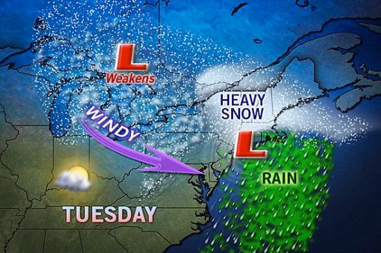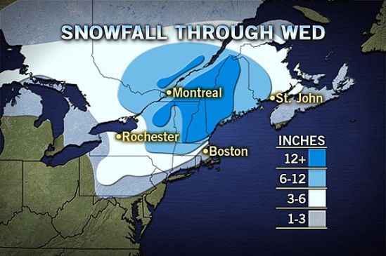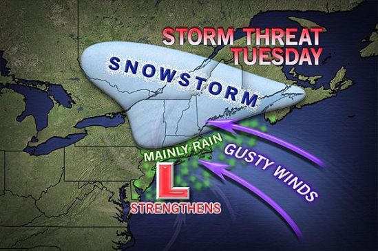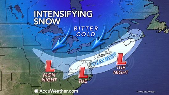
All the ingredients are coming together to bring us a potent storm for Tuesday afternoon into Tuesday night. As a cold front moves through the area today ushering in another arctic blast, it will be setting the stage for a coastal storm tomorrow. As the front drops south through the region, a weak Albert Clipper will swoop down out of Canada and ride along this front. When this storm makes contact with the warmer Atlantic waters, it will blossom into an all out southern New England snowstorm. Winter Storm Warnings have just been posted for New Haven for heavy snow accumulating 6-10 inches! This snow will accumulate rapidly as it will be brutally cold. This allows for a greater snow ratio. Usually we get about ten inches of snow for every inch of rain , but as it will only be around 10-20 degrees tomorrow and tomorrow night, we will be getting more like 20-30 inches of snow for every inch of rain.
Snow should invade the area around 3pm tomorrow. It will get heavier and steadier heading into the evening. It is going to be very windy and wind chills will be below zero Tuesday night. Plan ahead and be careful if you have to be out tomorrow night! Lots more to come with this developing storm! Stay tuned! -SS